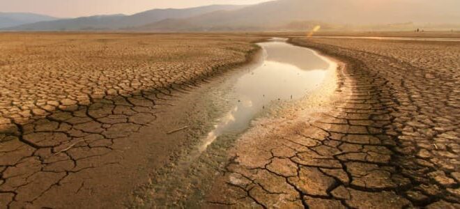
The UN climate conference, COP29, held in Baku in November garnered plenty of global attention. But another, lower-profile UN-sponsored COP, shorthand for conference of parties, convened earlier in December in Saudi Arabia. That COP tackled another global warming-related challenge – the spread of desertification.
Barron Joseph Orr, the lead scientist for the UN Convention to Combat Desertification (UNCCD), cautioned at the COP about a “knock-on effect” in which warming-caused loss of agricultural land can cause the loss of biodiversity, reduce living standards, and spur migration from rural communities to urban areas.
“You can move along for a while and not notice the impact. But when you cross a threshold, then you are not going to turn back,” he said, referring to the ability to reverse the damage done by land degradation.
Kazakhstan was a prominent participant at the UNCCD-sponsored COP. Almost a quarter of the country’s vast territory is steppe. Around Baikonur, on the north side of the Syr Darya river, it stretches in a seemingly endless expanse of yellow-brown scrubland populated with herds of camels, cows, and free-roaming, speedy Adaev horses.
The country encompasses roughly 272 million hectares (672 million acres), almost two-thirds of which is considered pastureland. Up to 90 million hectares (222 million acres) of Kazakh territory is classified as eroded or erosion-prone land, according to the latest national development plan. More than 75 percent of agricultural land is subject to degradation, and 62.5 percent of arable soils are low in essential nutrients.
Major causes of erosion are poor crop rotation and lack of fertilizer, especially organic. Climate change and anthropogenic factors are also driving the process.
Desertification is a serious problem in seven of the country’s 17 regions. In western Kazakh regions, rising temperatures and reduced rainfall are the chief causes. In the northern regions of Kostanay and Akmola, the trend is exacerbated by intensive agricultural and livestock farming practices.
In Kyzylorda, around the depleted Aral Sea, the creeping desert is particularly vulnerable to anthropogenic factors and climatic stress. Aralkum, one of the world’s youngest arid zones, is a massive generator of dust and salt storms. Between 1960 and 1984, it spewed up to 75 million tons of salt and other toxic pollutants every year.
Kazakhstan has now teamed up with Uzbekistan to draw up “a roadmap to combat drought as well as sand and dust storms in the Aral Sea region,” Maria Zadneprovskaya of the International Fund for Saving the Aral Sea told Eurasianet.
As of October, the bilateral working group has met three times, with more meetings planned. Their cooperation is part of the ERAS II environmental restoration effort, Zadneprovskaya added. The initiative includes representatives from the Kazakh Ministry of Ecology and the Uzbek Ministry of Water Resources, among others.
All land use in Kazakhstan – agricultural, commercial, and industrial – is based on functional zones as established in the country’s land code. These zones are defined according to the quality of the land, its ecological condition, its intended function, as well as special regulations.
“What the current zoning does not take into account is a landscape approach,” Talgat Kerteshev of the Kazakh National Agrarian Research University told Eurasianet. Landscape planning means treating the ecosystem as a whole and creating a framework for its sustainable use, said Kerteshev, who previously worked with the United Nations Development Programme.
This holistic approach involves looking at climate, vegetation, wildlife, community needs, and the contours of the land. The latter is particularly important in the foothills near Kyrgyzstan, where mudslides are common.
Another challenge is the unsustainable use of grazing land. Kazakhstan has 180 million hectares (444 million acres) of pasture, of which only about one-third is in regular use. “But most of the cattle graze around the auls [villages]. The kind of nomadic herding that our ancestors used to do is no longer there,” Kerteshev said.
Decades ago, the rotation system gave the pastures time to recover, especially in spring. Now the land is overworked and quickly falls into disuse. The total area of severely and moderately run-down pastureland is 26.6 million hectares (66 million acres) – and growing.
In 2017, Astana pledged to achieve land degradation neutrality by 2030, a target set under the auspices of the UN. The country also adopted strategic goals to combat desertification. However, the document is non-binding and remains largely recommendatory.
Kazakhstan has launched a plan to plant 2 billion trees by 2025, many of them in the Aral Sea region, but many ecologists say the focus should be on survival rates and retention rather than numbers.
The country also boasts a strategy to achieve carbon neutrality by 2060. However, a viable, binding, and detailed implementation plan for tackling desertification is yet to be seen.
Kerteshev believes that an essential part of any sustainable plan is a detailed and multi-dimensional land map: “You can’t work with your eyes closed.” An incentive for creating digital agricultural maps was announced in September. They will build on the land monitoring of the State Institute for Land Surveying (GIPROZem), the Kazakh Ministry of Agriculture said.
Kerteshev is convinced that environmental planning in Kazakhstan needs to make greater use of satellite imagery and datasets from Landsat and ASTER.
“With the desertification indicators, we have developed a method to determine the level of land degradation using space sensing,” he said. “Without a systematic approach, no progress can be made.”

 Iran Energy News Oil, Gas, Petrochemical and Energy Field Specialized Channel


